Well, true to our commitment in 2002, we went back to Baffin Island and the Akshayuk Pass in Auyuittuq National Park. Unfortunately Peter could not join us, neither could Bohdan. So Roman and I did it alone. Somewhat heavier packs but with greater determination, we completed the entire traverse this time, from North to South, 100 kilometres of the Akshayuk Pass. It was different the second time around. We knew what to expect more, so we had a better opportunity of noticing some of the other aspects of the trip, details that we did not notice the first time around. We paid more attention to how people live in Pangnirtung and Qikiqtarjuaq. The photos below, and the associated comments, chronicle our journey.
Roman and I at Summit Lake, the highest point on the trail
Waiting for our plane in the Maple Leaf Lounge in Montreal at the Pierre Elliot Trudeau Airport
Our First Air plane making a stop in Kuujjuaq
We had about 30 minutes. We got as far as the welcome sign. The tree line stops about here.
Iqaluit's harbour (such as it is) on Frobisher Bay. Although promised for a long time, Iqaluit does not have a deep water port. All goods have to be brought from ships anchored a kilometer off shore, by barges. A slow and expensive process.
At the water front with Iqaluit in the background. The large building to the right is the Frobisher Inn, the largest hotel in town.
We spent a night at the Capital Suites. Not many services, but not bad. The people are very friendly and helpful.
The Nunavut Parliament building
I just had to get a picture of this, with me running.....
A view of Pangnirtung from the air coming in. The large black building in the upper right is the new medical clinic being built by SNC Lavalin.
Our First Air Hawker Sidley after landing on the gravel runway in Pangnirtung, on the South Pangnirtung Fjord
We put up the Nunatak tent in the campground which has been recently relocated to be up hill from the town. It has some nice windbreaks.
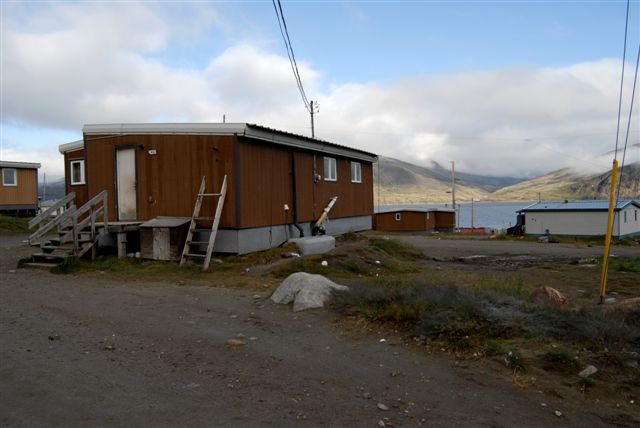
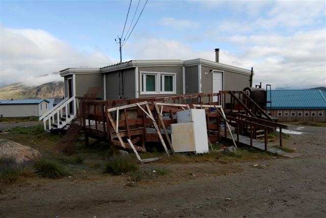
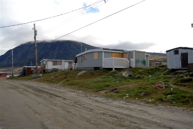
Some typical homes in Pangnirtung. Its over 90% Inuit.
The local cemetery. We walked through looking at the graves. Some date back to the early 1900's.
One of the 2 churches in town, simply known as the Pangnirtung Community Church.
The medical center under construction by SNC Lavalin
Nightfall over Pangnirtung from our campsite
Sunday morning at the Duval River, a spot known as the "swimming pool". The kids were washing and swimming in what is rather frigid water.
Standing on the gravel runway on a Sunday morning. The gate was open and we just walked around. The whole town was asleep.
The backs of houses lining the runway
Pangnirtung's harbour with the tide receding
With the tide completely out. Because of the geography, the South Pangnirtung Fjord will get tides that exceed 7 metres in height
Roman standing by a cascade on the Duval River just east of Pangnirtung. We had a day to kill before our flight to Qikiqtarjuaq.
Flowers called arctic cotton or formally Eriophorum (Cottongrass, Cotton-grass or Cottonsedge) with the fjord in the background
On our way back from going up the Duval river for a couple of hours, Roman and I split up on our return. I circled wide to get a better appreciation of the lay of the land. I came across this artist from New York who had been in Pangnirtung since June (this was mid August). From what I could gather, he was painting abstract landscapes. Interesting, but not necessarily my cup of tea. We had a nice chat and he was on our return flight from Iqaluit to Montreal.
A view of the camp ground from above, with the water reservoir in the upper left.
Duval River with Mt. Duval in the background.
Pangnirtung from the air as we were flying to Qikiqtarjuaq. You can clearly see the gravel runway which divides the town into lower town, and upper town.
Ice floes near Broughton Island
Landing in Qikiqtarjuaq
Most of the northern communities are dry
There is a significant weather difference between Pangnirtung and Qikiqtarjuaq, even though they are no more than 250 kilometres apart.
Ice floes in late August in Qikiqtarjuaq
The streets of Qikiqtarjuaq. There is very little vegetation as compared to Pangnirtung. Its more like a Mars-scape.
The village church.
The house in which we stayed in, a "home stay" as they called it. It was Billy's mother-in-law's place.
The harbour in Qikiqtarjuaq
Billy Arnaquq' (billy_arnaquq@qiniq.com) took us into to the North Pangnirtung fjord, almost a 3 hour boat ride from Qikiqtarjuaq. About 100 kilometres.
Roman spent much of the time chatting with Billy and learning from him. An interesting and very pleasant outfitter that we would not hesitate recommending. A proud Inuit and citizen of Nunavut, Billy is also a proud Canadian, and a Canadian Ranger.
The sun was weak that day on that cold boat ride.
The famous "float suit". The locals don't even pretend to call it a survival suit. With the water temperatures at around 1°C, you are dead in 20 minutes. The suit will keep your body afloat and the colour allows for aircraft to spot your remains for the sake of your loved ones. You simply NEVER want to end up in the water. Its no wonder most Inuit don't know how to swim.
This point, in Inuktitut, loosely translates into "a sort of a reddish point". Apparently, its a rather descriptive language.
The emergency shelter and latrine in the North Pangnirtung Fjord, the start of the Akshayuk Pass in Auyuittuq National Park.
Enter all who dare......The beginning of our 100 kilometer odyssey
This is what all of the emergency shelters look like. To be used only in severe weather, or in emergencies, they house a couple of plywood bunks, and a side-band 2-way radio capable of transmitting over 100 kilometres for information and in cases of emergencies.
Looking north from the North Pangnirtung Emergency Shelter into the North Pangnirtung Fjord. About 30 kilometres out are the islands marking the Davis Strait, the open water between Nunavut (Canada) and Greenland. On the largest of these Islands, Broughton Island, is the town of Qikiqtarjuaq, once known simply as Broughton Island. The wind was blowing strongly from the south on our boat ride in so Billy had to keep the speed down on his boat as we pushed through the growing waves.
A view south from the North Pangnirtung Emergency Shelter giving a view of this part of the valley. Its wide, broad, and WET!!
The next 3 days were going to be a very tough slog through wet tundra and marshes, something that we had not seen on the south side of the pass in 2002
Shot northward as we were starting out, with the fjord in the background. Fresh and so full of promise....
The first boots-off stream crossing. There would be many. This time round we used MEC paddling shoes with a treaded rubber sole. They did a good job of keeping our feet relatively warm in the ice-cold water, better than straight sandals and wool socks, especially if you remembered to tighten the draw string....
Still smiling
Some of the rocks that have broken off the cliffs above are truly awesome in size, like this Easter egg specimen. Its like its been chiseled and hewn by giant stone smiths. Every now and the you could hear rocks crashing down the ravines way above us.
There was water everywhere and the tundra was 2 feet thick in spots, holding the water like a sponge as your boots sank through it
The cliffs across from the June Valley Emergency Shelter. On our third day, we were starting to get some hints of blue above, but the clouds were still obscuring most of the mountains around us.
A view looking South up the Owl River. In spots, the land was sandy and firm by the river. But this would go on for only several hundred metres, then the marshes would begin anew and we would be forced to find a new route. We often ended up walking near the bases of the cliffs to the left of us in order to walk on firm ground.
In spots, the sediment has accumulated to depths of 5 or 6 feet. The Owl River is constantly eroding these shores, carrying the sediment out to sea. The water in the rivers is a constant milky grey, showing the glacial sediment that it is carrying
The weather kept improving that third day, keeping our hopes up
Water, water, water
Roman's feet were soaked by this time. To his right is Mount Asgard, the only time we would get a view of it. By the time the weather truly cleared, we were too far south to get any views of it. It was a shame we could not get a better view of it. It is world famous. A scene in the James Bond move "The Spy Who Loved Me" featured Mount Asgard.
Nearing the top of the pass at around 1,500 feet ASL, is the massive intersecting moraines of the Highway and Norman Glaciers. Its like walking through a post-apocalyptic urban landscape. Its a jumble of rocks, huge and small, many very loose, just strewn about. Its goes on for over 5 kilometres. This giant moraine now blocks the northern outlet of Glacier Lake so the Owl River is simply a collection of streams that flow down. It no longer carries any water from Glacier Lake. The moraine has also trapped this large glacial melt lake, discernible from the regular run off by its deep blue colour. Although the weather was improving, at that altitude the clouds were still stubbornly sticking around.
Finally Glacier Lake, which is linked to, and is on the same elevation as, Summit Lake. This was the highest we would climb. Scampering over the giant moraines left us exhausted
We found a nice sandy spot on the shore of Glacier Lake and we called it a day. Up ahead is visible the huge moraines of Turner Glacier, something we would have to negotiate before we arrived at Summit Lake Emergency Shelter and Warden's Cabin.
The Nunatak tent from MEC served us very well. Its positively cavernous for 2 people. I had added a net that hung near the ceiling and it proved useful for drying and airing our socks. The large vestibules forward and aft can hold a lot of stuff protected from the weather. We never saw very high winds at night so the tent wasn't truly tested in that regard.
Just relaxing by Glacier Lake.....The Crocs we picked up in Pangnirtung were a very nice addition. It allowed our feet to breathe and be unencumbered after a day's hiking
The walking sticks are invaluable for the stream crossings. It really helps balance and stability. Here Roman is crossing one of the braids of the Turner River, flowing form the Turner Glacier. Its moraines divide Glacier Lake from Summit Lake
By this time Roman had developed substantial blisters on his heels because of his wet boots. This required care at almost every river crossing. My boots remained dry but I had a blister on one heel as well. Our packs were quite heavy. Probably over 60 pounds and the terrain of the first few days was quite rough and this most certainly contributed to the blisters. In the upper third of the picture and to the left of the large boulder, is a large yellow pail with a lid. This is an emergency cache. There are 4 of them in Akshayuk Pass along the trail, typically at some of the more difficult crossings. This one is on the Turner River, which can be a difficult crossing later in the day when the river is running high form the day's melting. The emergency caches hold food, fuel, a stove some warm clothing, etc. They are to be opened only in dire circumstances when you have fallen into the river (which is about 1°C) and your survival depends on getting warm clothes on and your core temperature up. People have died here from hypothermia. The most dangerous aspect of hiking the Akshayuk Pass is not the potential of polar bears, but the stream crossings
Clearing the last of the Turner moraine and Summit Lake behind me. Just to the right of me, perhaps 20 kilometres away, is visible the vertical face of Thor Peak, rising 3,000 vertical feet above the Weasel River
The day we walked from Glacier Lake to Summit Lake the weather really improved and we had our first really nice day. Our spirits rose
Summit Lake is several kilometres long but an easy walk
There are beautiful views at almost every turn
The Caribou Glacier moraine is the only thing separating us from the Summit Lake Emergency Shelter and Warden Station, but we were not in a hurry. There was a stiff and cool northern wind blowing, but we were enjoying the clearing skies. To the left of me is Thor Peak and to the left of that is Breadablik Peak
Tupermit Glacier. This view shows how the glaciers are receding, leaving behind their moraines in a jumble of crushed rocks and gravel. Its like a giant bulldozer had come through, the plaything of giants
Breadablik and Thor
Late afternoon and we were approaching the Summit Lake station. At the back is the moraine from Nerutusoq Glacier
The warden's cabin at Summit Lake and the latrine. In 2002 this was a busy spot with about 1/2 a dozen tents. This time round, we were alone and the warden's cabin was padlocked. The season was waning
We decided that since we had some spare time, we would spend a day and 2 nights at Summit Lake. Roman wanted to give his blisters a rest, so I took the opportunity of a spare day in beautiful weather to do some exploring, similar to what we did 5 years ago. Above is the Caribou Glacier which comes down just behind the warden's cabin. I did not venture much further as the moraine was getting very fresh and the large boulders rather loose. No need to have my arm pinned resulting in the need for self amputation.......
From Caribou Glacier, I followed the slope at a constant elevation southwards. My aim was to hit the waterfall caused by a stream flowing past Tyr Peak from the Penny Ice Cap. I had some wonderful views. We had sat by that waterfall 5 years ago, but I wanted to hit a spot above the waterfall, for better views
This view shows clearly some of the features of glaciers and moraines. Summit lake and the Owl and Weasel Rivers, are chalky with sediment (clay) brought down by the streams form the melting glaciers. As the glaciers melt, they leave behind their huge debris fields, moraines. However, these moraines often have ice still underneath as the debris insulates the ice from melting. The glaciers still melt under the moraines but at a slower pace, and their melt water seeps out, sometimes in streams, but sometimes the melt water collects in large ponds, such as the one shown on the right. The water is a beautiful blue colour because it carries none of the sediment of the crashing streams. The moraines, in this sense, are said to be "ice cored". The Summit Lake warden station is visible in the left third of the picture, nestled against the moraine of Caribou Glacier
The Weasel River flowing towards Thor Peak
By the stream I found a lovely spot in the grass for a nap in the brilliant sunshine. Sheltered from the wind, it felt like 20°C or more. I kicked off my boots and took this shot. In Auyuittuq the perspective of distance gets confusing. My boots area couple of feet away from me. The Weasel River is about a kilometre away. The glacier, at my elevation is probably about 3 kilometres away. I actually fell asleep to the sound of the crashing stream to my right
A good view of Breadablik Peak with its Weeping Glacier
This is the stream, as it cascades above the water fall, with its multi-coloured mosses. My camera is being held horizontal. The slope was quite severe and I almost got myself into serious trouble by scampering along the stream. At one point I found myself slipping along the stone face to the waterfall below and realized there was not much to stop me from a 100 metre plunge. It required a lunge at a rocky outcrop, a sprained shoulder and a cut finger to stop myself. It was then that I decided it was foolish to linger and I headed back down to camp. But I had a gorgeous afternoon.
The Weasel River as it flows towards Thor Peak. Old ice is clearly visible on either sides of the river, in the same spot that it was 5 years ago. We suspect that it never melts completely
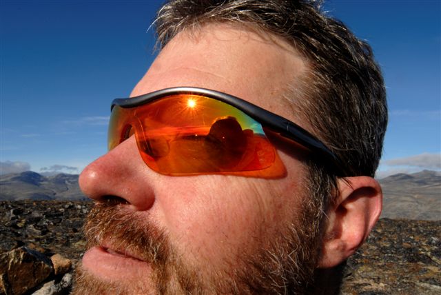
A self portrait
An Inukshuik just above our tent at Summit Lake
Roman spent that afternoon napping and reading in the tent. He claimed the temperature in the tent in the sun topped 30°C
The side band radio in the Summit Lake Emergency Shelter, identified as "Portable 7". The Parks Office had instituted daily broadcasts over the radio, at 08:45 and 4:45, giving the weather forecast, any news of bear citings, allowing any individuals in the park to call in problems or emergencies, etc. We would always listen to these when we could, and started conversing with the parks personnel. It was fun.
Instructions for the radio
The many rules and regulations governing the use of the park. Things seem to have become more bureaucratic in the last 5 years
Our album cover shot at Summit Lake
Summit Lake in the morning of the day we continued our journey
That was the best weather day we had. Sunrise till sunset without a cloud in the sky
The trail towards Thor Peak
The Weasel River goes through some wicked rapids as it starts off from Summit Lake
We were starting to become rather nimble at the rock jumping thing
Some of the streams ran rough, kicking up a fine mist into the air
The colour of the sky was amazing, with no humidity in the air. I did not use any filters on my camera. All of these shots were taken with a Nikon D200 10 mega pixel camera with a 18 - 35 mm Nikkor 3.5 lens. Most of the shots were taken at the equivalent of 100 ASA, although some low light shots were boosted to 400 and 800. I was very pleased with how the camera performed, in particular the flexibility in the metering options. Large landscapes can be difficult to photograph, in particular when there are clouds in the sky. You often have to overexpose the sky to have a good exposure of your subject matter. Azure blue skies, as seen above, pose no such problems.
A good view of the old ice on the Weasel River. We estimated the thickness to be at least 2 metres. We suspect that it never melts
One of the toughest stream crossings is 1/2 Hour Creek. Even at 09:00 it was lapping at our privates. Many hikers, arriving here in the late afternoon, wisely choose to pitch up a tent and wait for early morning to cross. The flow can vary by more than 300% over a 12 hour period. Due to the force and temperature of the water, the rule is to undo your waist belt and loosen your shoulder straps when crossing. People have drowned by slipping and falling into the water, pulled under by their heavy packs.
Letting the feet dry and warm up was an important and satisfying activity. Even with the neoprene booties, the feet and toes got awfully cold. It would sometimes take quite a while for them to truly come back to life.
Getting close to Thor Peak, with its 3,000 foot unbroken granite face, a Mecca for climbers the world over. The actual height of the mountain is about 4,000 feet, which includes a 1,000 foot high base. The 3,000 foot unbroken vertical, it is claimed, is the tallest unbroken vertical face in the world available to climbers. It is the stuff of legends.
Amazing beauty that few venture to explore. And only in Canada!
Roman, with a commanding view of the Weasel River. Too bad Base Jumping has been forbidden in the park.
Looking north up the valley towards Summit Lake from near the base of Thor Peak
The Thor Emergency Shelter. On the lee side of the shelter with the sun coming in from the south, we sunbathed like we were on a Caribbean beach
Our tent and Thor Peak. Its quite something to sleep in its presence.
The post between the Emergency Shelter and the latrine, holds the antennae for the side band radio. There were some old caribou antlers near by that were asking to be used as a prop.
Many of the mountains and peaks in the valley, in particular in weather like this, made me think of granite cathedrals, a place of the gods.
The following day, leaving Thor Peak and heading south. You can see how well traveled this section of the trail is
After leaving Thor Peak, we passed a group of 10 from Blackfeather. They were snacking on peanut butter, cheese, and other goodies. None was offered to us. I thought that we looked rather starved. I guess we must have still looked alright and not in need of much assistance.....
Standing on acres of sand marveling Thor Peak.
The famous suspension bridge over the Weasel River, formally known as the Windy Lake Bridge. One at a time, please!
A view from mid-span on the bridge
Roman doing his Atlas thing. We tried to estimate the weight of such rocks (boulders?) but quickly ran out of brain power for it
We were getting close to the Windy Lake Emergency Shelter and Warden Cabin. The falls in the upper right are the Schwartzenbach Falls which empty a large glacial lake in the Qijuttaaqanngittuq Valley above. I was studying the slope to the right of the falls when we were there, wondering that it looks like you could scamper up there. And apparently you can. The hyperlink above gives you some info on that. There are only a few places where you can safely walk out of the valley without requiring technical climbing. Everything West of the Akshayuk Pass (to our right as we were walking) drains out of the Penny Ice Cap, the last remaining piece of the last Ice Age ice that we have in Canada. Its about 300 metres thick and covers 6,000 square kilometres. And it is melting.
The clouds of that late afternoon were harbingers of the change in the weather to come
A closer view of the Schwartzenbach Falls from the Windy Lake Emergency Shelter and the Warden Cabin
The day after, we woke up to rain and wind. A radical change from the day before. And this for our last day. Just like 5 years ago, we would walk out of the Akshayuk pass in the rain and cold. Here I am running across the Arctic Circle, known as Ukiuqtaqtuup in Inuktitut at 66º 33 ½' North latitude
Finally at the Overlord Emergency Shelter and a chance to change into dry clothing, waiting for our outfitter to pick us up. This was day 8 and 100 kilometres of hiking later. Apparently the shelter was named for someone who had died here of hypothermia. As much fun as it was, you have to approach such adventures with a clear head and an eye on the risks involved. I would hope that the risks would not deter too many people from undertaking such wonderful experiences, but you do have to be prepared, informed, and accept Mother Nature on Her terms.
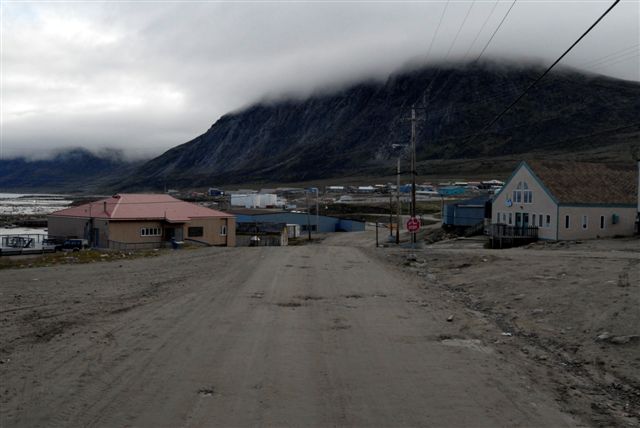
We had a day and 2 nights in Pangnirtung upon our return from the park. Here are some more shots of the town.
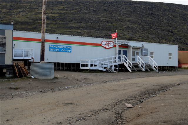
The Inuit Co-op for buying groceries and dry goods. The prices are relatively good although the selection is sometimes wanting. Remember, that everything is either shipped in during the short summer, or flown in at great cost. Your choices get limited.
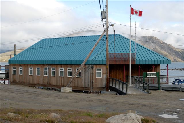
The Canada Parks where Billy Etooangat works. He helped us with some of the logistics of the trip planning by e-mail and it was good to meet him finally. He had helped us 5 years earlier, but we never had a chance to meet. Billy was born in Pangnirtung, apparently the first successful caesarean birth in Canada's high Arctic. The Akshayuk Pass was named after his grandfather. If you are interested in planning a trip, or finding out more about the park, feel free to e-mail him Billy.Etooangat@pc.gc.ca
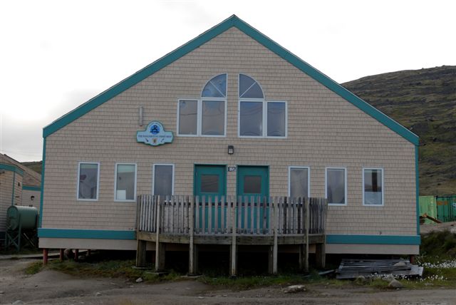
The Pangnirtung Print Shop
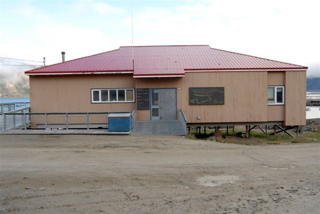
The Angmarlik Interpretive Centre
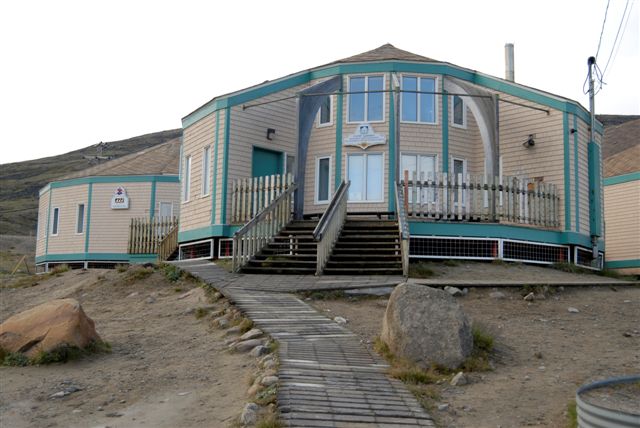
The Uqqurmiut Centre for Arts and Crafts
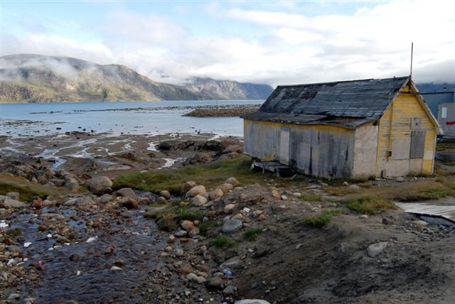
And old hut by the harbour
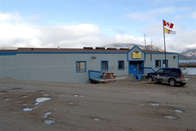
The Pangnirtung Hamlet Office and Community Centre
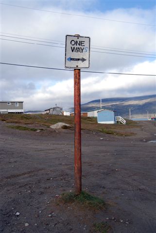
Rules are different up there....
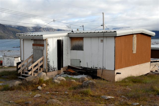
Not my place to wax political, but Pangnirtung, like most other high Arctic communities, has issues that it must deal with, such as a quickly growing population with not much to do, property crime, decay, limited employment and career opportunities. While everyone we met was extremely nice, polite and helpful, you can't help but wonder that they have a lot of work cut out for them in the future, if they intend to make these towns (hamlets) work
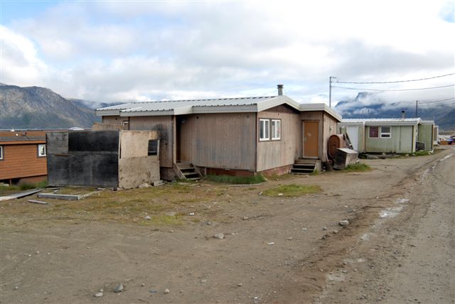
These shots are all of the older part of Pangnirtung
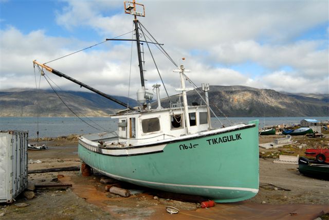
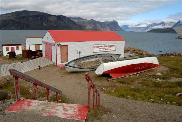
The old Hudson's Bay Blubber Station
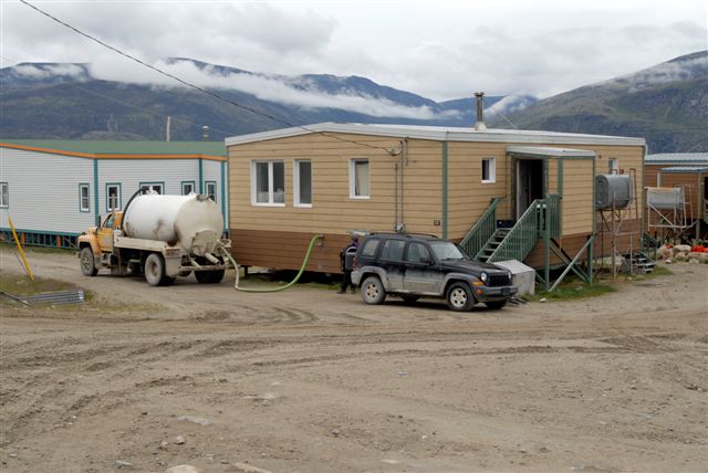
The ground is permafrost, so you can't pass any utilities through the ground. Every home has a sewage tank (that must be kept from freezing), a fresh water tank with pressuriser, a home heating fuel tank. Here a tanker is emptying a sewage tank located in the crawl space in the first 4 feet of the home. Fresh water is brought in by similar trucks (hopefully not the same trucks!)

Charlie Komoartok. He is the outfitter who had transported us 5 years ago, His partner, Jimmy, took us out this year. Charlie was busy with his other affairs, such as negotiating the next union contract for the Hamlet civil service. Charlie had apparently extended his reach. We bumped into him on the street and had a good chat.
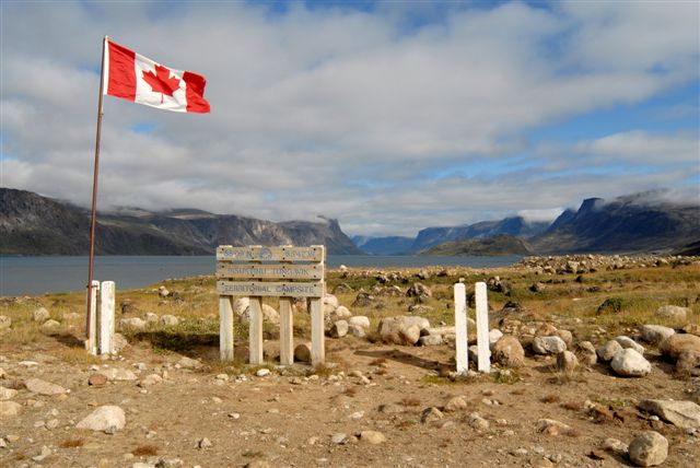
The territorial campsite which doesn't appear to be used very much anymore
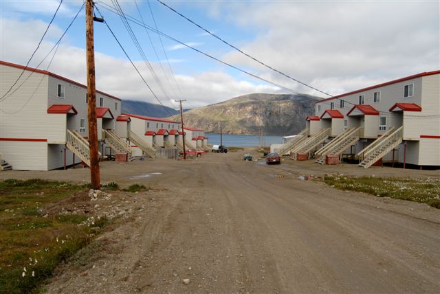
Some new houses in Pangnirtung, built to modern standards. The town has expanded rapidly in the last 5 years
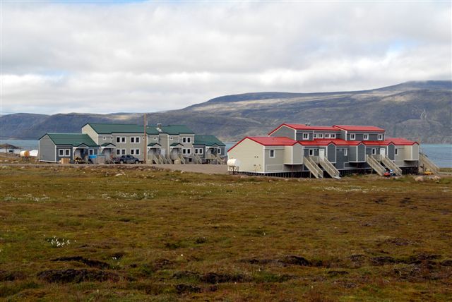
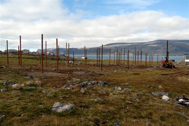
Because of the permafrost, there are no basements or foundations. Holes are drilled about 15 feet into the permafrost and steel pipes are rammed in. The houses are then built onto these pipes.
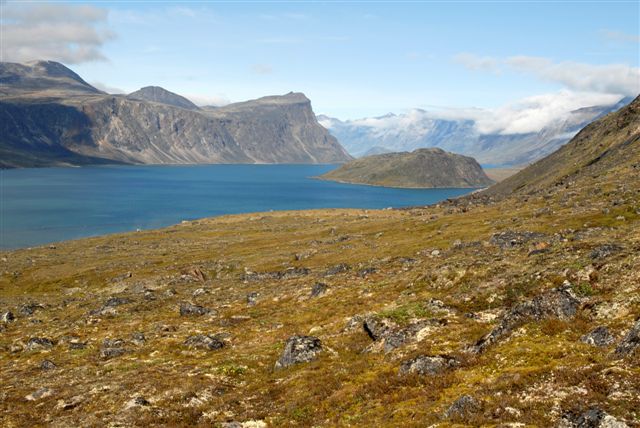
We had a free day to kill in Pangnirtung, so we decided to climb up Mt. Duval that overlooks the hamlet with an elevation of about 2,250 feet
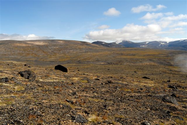
The cool thing about the high arctic, is that you can walk forever, except for mountains, etc. There are no forests or bushes to get in the way. You can see forever, and you can choose to walk wherever you want. You can walk for days on end. Unless you know the terrain very well, you would be wise to take a GPS with you.
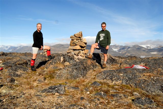
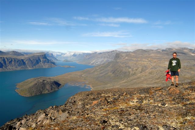
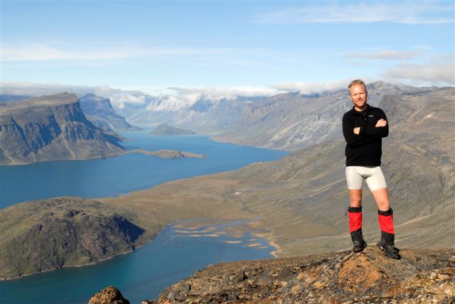
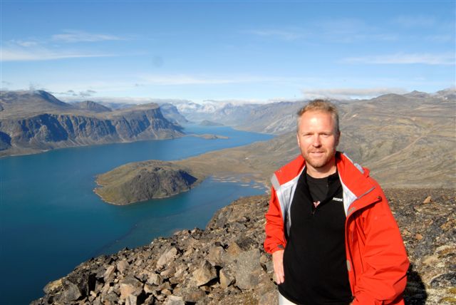
The very top of Mt. Duval, at 2256 feet above the Fjord
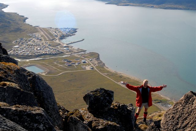
The slopes on the Pangnirtung side are very steep cliffs. But it gives you an interesting perspective of the hamlet
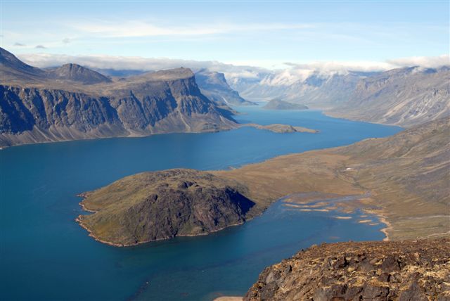
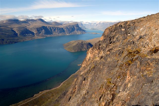
The view looking north into the South Pangnirtung Fjord. The park entrance is just out of view around the final bend to the left
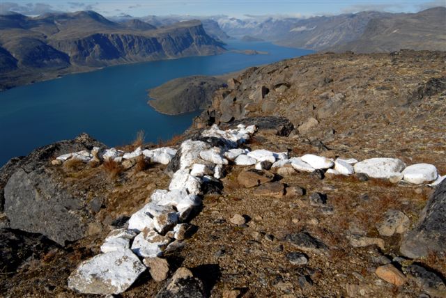
An aerial marker at the top of Mt. Duval, either for commercial or military uses
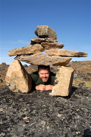
Roman hamming it with an Inukshuik
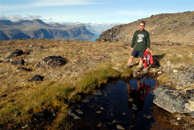
A reflecting pool of rain water
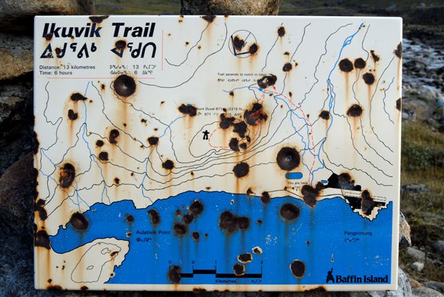
A beat-up sign of the trail to the top
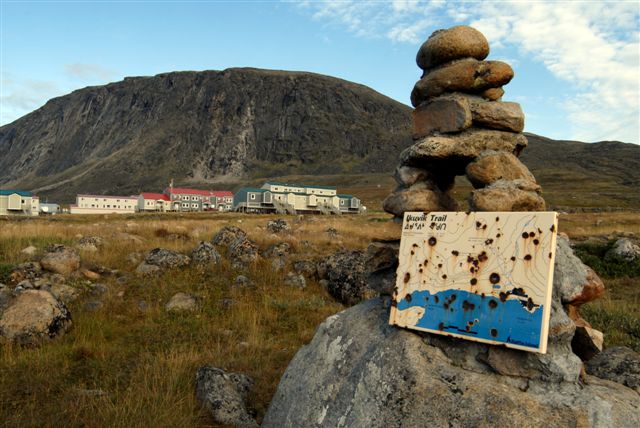
A view of Mt. Duval, with the new housing in the foreground
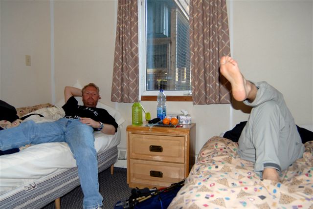
Cooling our heels at the Auyuittuq Lodge. They only had a small room available, but its a good place to stay. If you take the meals package (and you should) you get 3 VERY square meals a day. It was a good way to ease back into civilization.
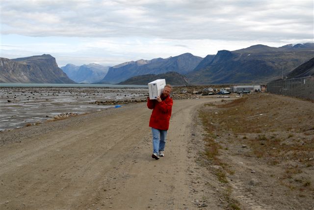
Carrying back a 50-lb box of Arctic char from the Pangnirtung Fisheries.
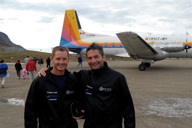
Ray Zahab, on the right, (from Chelsea, near Ottawa) and his partner Chuck (from Arkansas). Ray is an ultra-runner and you can read about his various accomplishments and exploits on www.rayzahab.com These 2 had just finished running the first leg of Rays 3-leg challenge of running extreme trails across Canada. What Roman and I took 8 days to hike, these guys RAN in 27 hours!! Ray then ran the East Coast Trail and the West Coast Trail, all in 9 days. I don't know how he does it but he does, raising money for charity in the process. Ray does a lot of motivational speaking for executives and school children. To speak with him is to feel like you are running out of breath. The man simply does not stop. He has endless energy. I urge you to visit his site and learn more about what he has done, and what he is planning to do. He was part of a trio that ran across the Sahara desert (8,000 km in 111 days!!) It is now a movie, to be released this fall, with narration by Matt Damon. These guys were staying at the Lodge as well, so we had some time to chat, and we were on the same plane together back to Iqaluit. The morning after their run, Chuck's feet were so swollen, he had to cut his crocs in half just to fit into them!
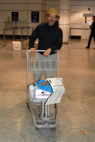
Finally at the Pierre Elliott Trudeau Airport in Montreal. It took them an hour to find our luggage, but the Arctic char was not lost, although a little bit bruised! I don't know if Roman and/or I will back in Pangnirtung ever again, but it was a very exciting, interesting, and fulfilling experience. If you want to know more about the park, or trekking in the North, please feel free to drop me a line at nestor@lewyckyj.com
So it goes...
All Photos © Nestor Lewyckyj 2007